
Battle Ground Neighbors by Source
Clark County records answer different questions about a block. MapsOnline draws the taxlots. PIC supplies a dated property report for each selected parcel. Landmark links recorded instruments to parcel IDs, legal descriptions, and named parties. City permit files describe work at an address. The county neighborhood directory describes volunteer association geography, not who joined a group. Washington voter data has a separate statutory request route and cannot be treated as a free block roster.
| Official source | Block-level fact | Access route |
|---|---|---|
| Clark County MapsOnline | Taxlot lines, adjacent accounts, and city, ZIP, district, permit, survey, or aerial layers | Public map with Info/Identify tool |
| Property Information Center | Dated situs, assessor owner, mailing, legal, value, sale, zoning, and photo fields | Public address/account search; owner-name search at Joint Lobby computers |
| Landmark | Recorded parties and instruments tied to nearby parcels | Online index from 1961; older help through Recording Department |
| Battle Ground CSS and city files | Permits, inspections, complaints, notices, and project status | Public address/parcel search; records request for gaps |
| County neighborhood directory | Association boundary and active or inactive status | Public address window; no member roster |
| Secretary of State voter extract | Allowed public voter fields with precinct and jurisdiction context | Defined request with statutory use limits |
A property owner may receive mail elsewhere. A recorded party may be a trustee, lender, personal representative, or lienholder. A voter entry reflects registration at the record date, and association geography does not prove membership. Labeling each role prevents a list of nearby records from becoming an unsupported claim about who occupies each home.
Map Battle Ground Neighbors
The documented MapsOnline parcel viewer route is Find Parcel, enter an address or tax account, choose the match, zoom to the parcel, and use Info/Identify. Pan just far enough to capture the lots that touch or face the starting parcel. Click each taxlot separately rather than assuming that one pin represents a whole block.
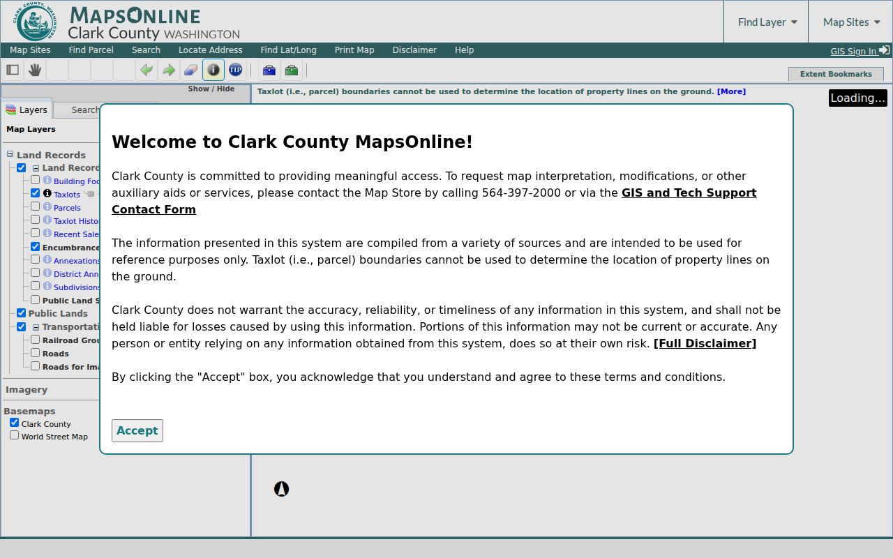
The captured county viewer shows why the map is the right first feature for neighbor research: boundaries and selectable parcels come before names. Turn on only the layers needed for the question, such as city, ZIP, neighborhood, precinct, school, utility, permits, surveys, or historical aerials. Record the map date and account number for every lot.
Walk a Battle Ground Block
A reproducible block search uses one row per parcel. Start with the address of interest, identify each nearby taxlot, and open a separate property report. That preserves the difference between a visual neighbor and a legal parcel. Corner lots, shared drives, and subdivision lines can make a block look simpler than it is.
- Locate the starting address or nine-digit PAN in MapsOnline and confirm its city and ZIP layers.
- Pan to each adjoining or facing taxlot and use Info/Identify to capture its account.
- Open each PIC report and transcribe the situs, assessor owner, mailing label, legal description, land use, latest sale, and report date.
- Search the parcel ID or legal description in Landmark when a deed, easement, lien, or plat is relevant.
- Keep any permit, precinct, association, or historical layer in its own field with a source date.
This produces a small parcel inventory, not a list of all Battle Ground neighbors who live there. The PIC owner and mailing labels are assessment data and neither alone proves occupancy. For the complete chain along one named road, switch to the Battle Ground street directory.
Read Battle Ground Parcel Reports
The Clark County Property Information Center accepts a full or partial street address or a tax account. Its report can show account number, situs, property owner, owner mailing address, legal description, tax and property status, area, assessment values, zoning, photo date, and the most recent sale row. Those fields need dates and exact labels.
- Parcel or taxlot
- A mapped piece of land identified by a county tax account.
- Situs address
- The physical address assigned to the parcel. It can differ from the owner's mailing address.
- Legal description
- The recorded lot, block, subdivision, or boundary wording used to identify land.
- Recorded party
- A person or entity named in an instrument in a stated role, not necessarily an occupant.
Public web users search by address or account. Clark County says owner-name searching is available from self-service computers in the Joint Lobby. If an online search fails, use MapsOnline's identify tool, visit the county counter, or ask the Assessor for the correct access path. Joint Lobby renovation was planned through the end of 2026, so confirm the current service location and hours first.
Battle Ground Neighborhood Boundaries
The Clark County neighborhood association directory can route an address to a volunteer civic area. Its boundary notes and status labels are useful, but no official citywide Battle Ground membership roster was found. Do not convert a boundary match into a claim that a household belongs to an association.
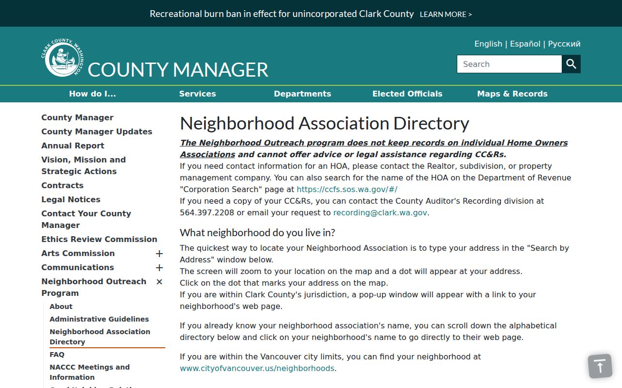
The county directory capture is a geographic and contact lead. Check the live status because groups may become inactive, change contacts, or adjust how they meet.
Meadow Glade
Status: Active
Boundary clues include NE 219th Street or SR-502, SR-503, Salmon Creek, Battle Ground, and NE 72nd, 112th, or 119th avenues. The group began amid a 1997 sewer and water transition and addresses roads, drainage, urban growth, and code concerns.
Greater Brush Prairie
Status: Inactive
Boundary references include Salmon Creek, NE 72nd Avenue, SR-503, Battle Ground, and NE 187th, 199th, or 219th streets. Use it as historical association geography, not a current civic contact.
East Fork Alliance
Status: Active
Its clues run toward the East Fork Lewis River, SR-503, Yacolt, Sunset Falls, and nearby county roads. Research found a 2020 postcard, about three meetings a year, sheriff and code liaison work, and a Battle Ground Library meeting lead.
Battle Ground Neighbors and Voter Data
Washington law makes specified voter fields public, including name, address, political jurisdiction, gender, year of birth, voting record, registration date, and registration number. Original registration forms are confidential. Protected categories and Address Confidentiality Program records must be withheld or handled under law. Voting history marks participation, not ballot choice.
Clark County Elections now directs voter-list requests to the Secretary of State. A useful request defines Clark County scope, Battle Ground precincts or political jurisdictions, a record date, the public fields wanted, file format, and the required use certification. ZIP alone is too broad. Countywide output must be localized with precinct and city-boundary fields before it says anything about a Battle Ground block.
Use the record date. Registration changes after moves, returned mail, death notices, cancellations, and other list-maintenance events.
Official Battle Ground Neighbor Records
Commercial neighbor tools often blend old addresses, unverified names, and data from unclear dates. Official sources are narrower, but they disclose their custodian, field meanings, and retrieval path. They are better for a parcel, boundary, recorded instrument, or civic status that can be checked again.
| Route | Strength | Limit |
|---|---|---|
| County and city records | Dated parcel, instrument, permit, or jurisdiction fact from its keeper | No complete household list; each record proves only its labeled role |
| Association directory | Current status and volunteer boundary clues | No proof of membership or occupancy |
| Commercial category | May offer broad name and address leads | Source dates, roles, and corrections may be unclear; never treat as official proof |
For personal safety, estate questions, reconnecting, or civic curiosity, retain the smallest amount of data needed. Verify two fields in independent official sources before combining same-name records. A current parcel report plus the latest recorded instrument can confirm an ownership label, but still cannot establish every person who lives at that address.
Privacy for Battle Ground Neighbors
A block search cannot reveal private utility or customer records, many household members, a person who is not named in a public file, or a current location inferred from an old deed. Washington's Address Confidentiality Program gives eligible participants a substitute address and protects the actual location in new state, county, city, and court records. If a substitute address appears, stop the search and do not combine it with parcel or voter data.
Lawful use. Research Battle Ground neighbors only for a lawful personal purpose. Never use public records to watch, harass, intimidate, or expose a protected person.
Corrections and access requests go to the agency that keeps the record. The Washington Public Records Act generally requires an initial agency response within five business days, which may produce records, give an estimate, seek clarification, or cite an exemption. Inspection is generally free, and copies may carry charges. Ask for the precise exemption and a log of withheld or redacted material when a response is incomplete.