
Walk a Battle Ground Street
A Battle Ground street directory begins with the exact address form printed on a current parcel report. That report can identify the tax account, physical site, assessment record, legal description, and the owner name displayed by the assessor. None of those fields, by itself, identifies every person living there. The sound method moves from the parcel to other records and records each person’s stated role.
- Enter the full or partial address in Clark County’s Property Information Center, then save the account number, situs address, owner label, mailing address, and legal description.
- Open MapsOnline, use Find Parcel, select the taxlot, and inspect neighboring parcels, city limits, recent sales, plats, permits, and other relevant layers.
- Use VoteWA for an individual registration check. For a public voter-list request, follow the Secretary of State route and its statutory limits.
- Search Clark County Landmark by parcel ID, legal description, filing number, or party name. Read the deed image or request a copy before stating what the filing does.
- For an older household, try Clark County directories, newspaper databases, census material, and address variants through the library.
This sequence keeps the work street by street. It also separates a parcel boundary from a mailing route and a registered voter from a deed party. If the goal changes to verifying one named person across multiple systems, the Battle Ground resident lookup follows that separate path.
Battle Ground Street Search Fields
The county’s Property Information Center, usually called PIC, is the best public starting point for a known address. Public web users can search a street address or tax account. Owner-name searching is different: Clark County directs that work to self-service computers in the Joint Lobby. Open Data receives a weekly refresh, but any saved result should still carry its retrieval date.
| Field | How it works | Street-search use |
|---|---|---|
| Street address | Full or partial text | Keep directionals and street type; try a shorter fragment if needed. |
| Tax account or PAN | Nine-digit account when known | Links the parcel report to maps and recorded documents. |
| Owner name | Joint Lobby computer route | Not offered as a complete public web search. |
| Map identify | Select a taxlot in MapsOnline | Reveals its geometry and nearby lots. |
| Parcel or legal search | Landmark tabs | Finds deeds, plats, easements, and related filings. |
The PIC capture below shows the official search surface used for Battle Ground-area parcels. Visit the Clark County property search before relying on the screen, since fields and verification steps can change.
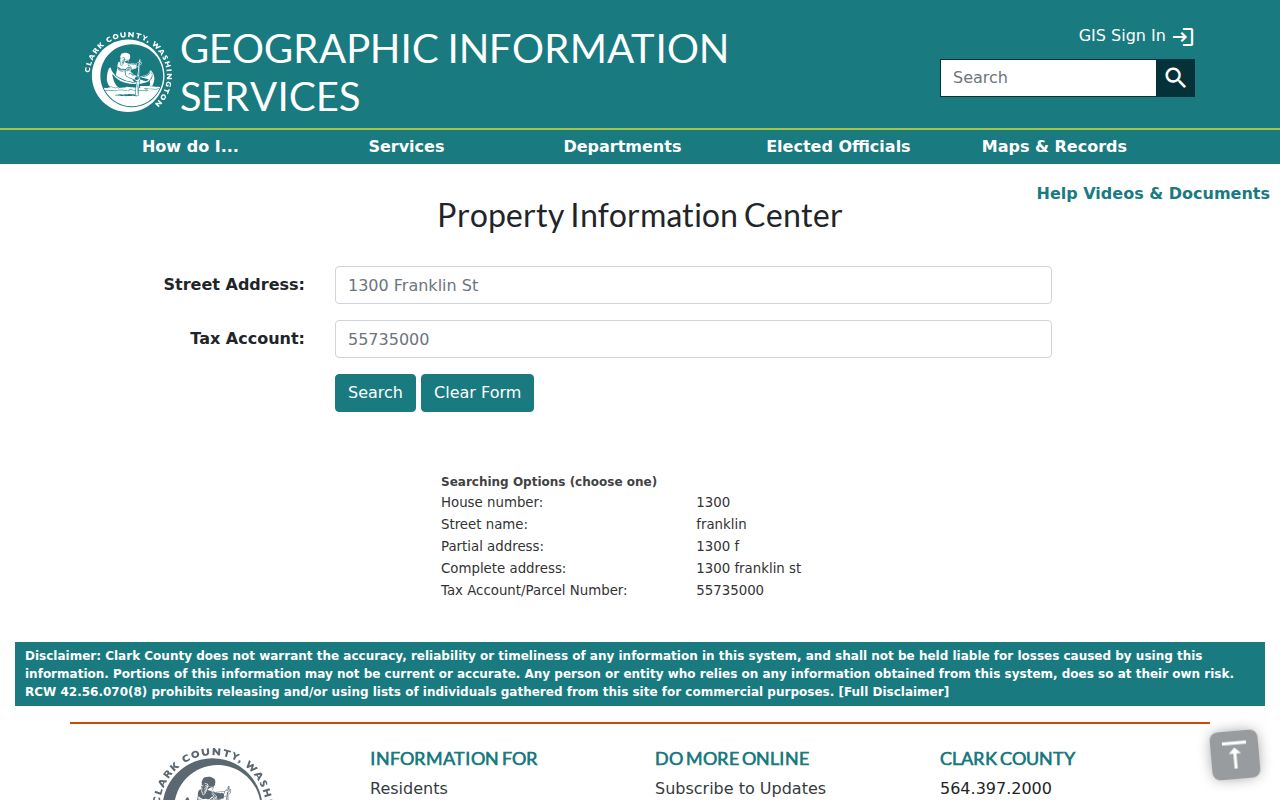
The image ties the street directory workflow to the county source, not to a commercial address list. A result should be opened and read as a dated assessor report.
Battle Ground Records by Address
No single roll supplies a complete street directory. Clark County and Battle Ground divide address evidence among property, map, recording, election, and city systems. The same address may be formatted differently in each. The parcel account and legal description are often more stable links than the street text.
| Address source | Custodian | What the record supports | Access route |
|---|---|---|---|
| PIC assessment report | Clark County Assessor | Situs, owner display, mailing address, values, legal description, recent sale | Free address or tax-account search; owner-name search at Joint Lobby |
| MapsOnline | Clark County GIS | Taxlots, boundaries, permits, plats, aerials, and map context | Free viewer and map index |
| Landmark recordings | Clark County Auditor | Deeds, liens, easements, surveys, plats, and party roles | Online index from 1961; public computer, mail, or office for copies and older help |
| Voter data | Washington Secretary of State | Public registration fields and political geography | VoteWA individual check or formal list request under state law |
| Permit and code file | City of Battle Ground | Project, inspection, complaint, warning, and order records tied to an address | CSS search, JustFOIA request, or City Clerk assistance |
The assessor tells what is assessed. The auditor tells what was recorded. GIS shows where the lot lies, while city records show local activity. Matching them creates a defensible by-address trail without claiming that every named party occupies the site.
Map Battle Ground Taxlots
Clark County MapsOnline turns a typed address into a spatial check. Use Find Parcel with a street address or tax account, select the match, then inspect the Layers, Search, and Info tools. County guidance documents partial searches such as a house number alone, a street name alone, or a short combination. That helps when suffixes and directionals differ.
Useful layers include taxlots, Battle Ground city limits, ZIP and census geography, precincts, schools, utilities, annexations, recent sales, historical aerials, subdivisions, surveys, plats, permits, and site plans. Not every mapped line carries legal force. Easements may be incomplete, and parcel boundaries are not proof of title. Follow the map link to the property report, then read the recorded plat, survey, deed, or easement for the legal terms.
The official viewer appears below. Open the live MapsOnline parcel map to select the current layers and confirm the map date.
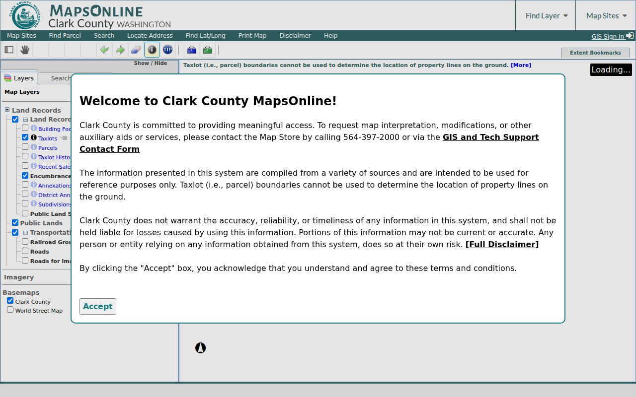
This map view supplies the street’s shape and taxlot sequence. Each selected lot still needs its own PIC and Landmark review.
Read Battle Ground Address Labels
A physical parcel address and a mailing address answer different questions. Clark County calls the physical location the situs address. It comes through the jurisdiction and planning process. The mailing address may come from recorded documents or a real-estate excise-tax affidavit. A trust, lawyer, business office, or tax contact can receive the mail. Treat neither field as automatic proof of occupancy.
- Parcel
- A defined unit of land tracked with a county tax account or taxlot.
- Situs address
- The physical site address assigned through the local addressing process.
- Plat
- A recorded map that lays out lots, blocks, roads, and other features of a subdivision.
- Criss-cross directory
- A directory arranged by street and house number, allowing an address to lead to a printed name.
Battle Ground postal labels add another distinction. ZIP 98604 is the main postal reference, while nearby 98606 covers Brush Prairie and Hockinson areas that may be described as greater Battle Ground. A ZIP label does not establish city limits. Confirm the city boundary in GIS before calling an address part of the city.
Deeds Along Battle Ground Streets
The Landmark Official Records Search connects a PIC parcel to recorded deeds and other instruments. Its tabs include Name, Document Type, Book/Page, Excise Number, Auditor Filing Number, Parcel ID, Record Date, Legal, Advanced Legal, Quick Search, and Marriage. For street directory work, parcel ID and legal description reduce errors caused by address spelling.
Online coverage begins January 1, 1961. Search the newest deed, read its prior recording reference, and then search the earlier party in the correct grantor or grantee role. A grantor transfers an interest; a grantee receives one. Continue through referenced filing numbers, book and page, excise number, lot, block, and subdivision data. Splits or combinations may change the parcel number, so the legal description matters.
The official result screen below comes from a Landmark indexed-record view. Capture the filing number, recording date, document type, party roles, parcel, legal description, and related instruments.
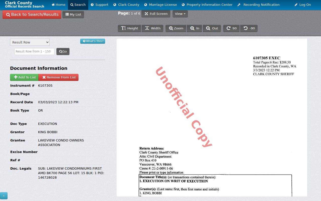
The online image is unofficial. Certified copies come from the Auditor in person or by mail; noncertified and certified copy charges differ.
Battle Ground Permits by Street
City files can explain activity that the assessment roll cannot. Battle Ground’s CSS system allows a permit search without an account. Search the site address, then note the permit number, project description, status, inspection events, plans, and linked approvals available in the record. City records may also show a complaint, warning, Notice and Order, or later closure. These are events tied to a site, not a roster of people living there.
When the public screen lacks the older or full file, use the City Clerk’s public-records route. Battle Ground moved city requests to JustFOIA on June 2, 2025, but municipal-court requests remain separate. A December 2025 eReview transition can split a recent project between electronic comments and legacy paper material. Ask for both parts by address and permit number. For land outside the city boundary, check Clark County Community Development instead of assuming that the city holds the file.
Older Battle Ground Street Clues
Early address work must account for changing geography. The railroad arrived in 1902, the first town plat followed in 1903, and Battle Ground incorporated in 1951. An old listing may use Battle Ground as a post office or county locality rather than today’s municipal boundary. Old Town and East Main terms, rural routes, and nearby place names should stay exactly as printed until maps and plats connect them to a current parcel.
The Washington State Library lists Clark County directories for 1918–19, 1921, 1928–29, 1931, and 1934. That is not a continuous Battle Ground-only run. Search by surname, initials, business, street, and post-office label. Fort Vancouver Regional Libraries offers in-library Ancestry Library Edition plus HeritageQuest, Newspapers.com, NewsBank, FIMO maps, and local books. The full collection and reading method belong on the Battle Ground city directory page.
Pair a directory hit with a census, newspaper page, deed, plat, obituary, tax parcel, or permit. Never fill a missing year by assuming the same household stayed put.
Offline Battle Ground Record Routes
Web searches have real cutoffs. Landmark begins online in 1961, and older deeds require Recording Department help. The Auditor also provides public-computer access plus mail and in-person copy routes. Certified copies cost $3 for the first page and $1 for each added page; noncertified copies cost $1 per page. The free Recording Notification Service can watch a name, business name, address, parcel ID, or short legal description, though an alert is only a lead.
Assessor owner-name searches are available on Joint Lobby self-service computers, not on the general public PIC form. The Joint Lobby combines Assessor, Auditor, and Treasurer service, but a renovation planned through the end of 2026 may affect location or hours. Check the current county notice before visiting. For voter-list data, Clark County Elections directs requests to the Secretary of State. For directory and newspaper gaps, use Battle Ground Community Library, FVRLibraries access, Washington State Archives, or Clark County Historical Museum research.
Battle Ground Street Directory Limits
A street directory can document parcels, recorded parties, public voter fields, permits, and printed historical entries. It cannot prove that every household member is listed. A voter may be absent from a requested file, a directory can omit a person, and a parcel owner can live elsewhere. Washington’s Address Confidentiality Program provides a substitute address for eligible participants and protects certain voting and marriage records. Stop trying to combine address sources when protected information appears.
Washington voter data has defined public fields, while original registration forms and protected fields are not public. State law restricts use of voter lists for advertising and other commercial purposes. Motor-vehicle personal data is also limited by federal law. Those boundaries are part of an accurate search, not gaps to work around.
Lawful use. Use Battle Ground address records for lawful personal, family-history, property, and civic research. Never use a street search to stalk, harass, threaten, or expose a protected person.