
Battle Ground Address History Sources
Previous residents leave different records in different eras. Begin with the source closest to the date in question, then use a second kind of record to test it. A deed establishes a recorded transfer, while a directory or census can identify a household. Maps and plats keep the address tied to the same ground when names and numbers change.
| Historical source | Time covered | Access point | Evidence it adds |
|---|---|---|---|
| Landmark official records | 1961 to present online | Clark County Auditor web index, public computer, mail, or office | Recorded parties, deed type, date, parcel, legal description, references |
| Digital Archives land title | 1998–2021 conservative title range | Washington Digital Archives | Party, role, year, document class, addition or subdivision keywords |
| Earlier county deeds | 1859–1921 deed images; index leads through 1977 | FamilySearch and county Recording Department | Older transfers, deed books, grantor/grantee trail |
| Clark County directories | 1918–19, 1921, 1928–29, 1931, 1934 | Washington State Library and library research tools | Printed names, addresses, work or business labels, phones when printed |
| Census and newspapers | Public census schedules under the 72-year release rule; database windows vary | FVRLibraries genealogy databases | Household composition, news, ads, obituaries, and moves |
| Maps, plats, and aerials | Coverage varies by series and layer | MapsOnline, State Library, archives, and Library of Congress leads | Lot identity, structures, roads, subdivisions, and changed geography |
For a recent Battle Ground property, start with PIC and Landmark. For an early Old Town address, directory, plat, newspaper, census, and deed-book work may all be needed. There is no complete Battle Ground-only directory run, so a blank year cannot be filled by assumption.
Anchor Battle Ground Previous Residents
The current Clark County Property Information Center report supplies an account number, situs address, displayed owner, owner mailing address, legal description, property status, area, assessment fields, city or county jurisdiction, zoning, photo date, and recent-sale information. Save the report date. The owner field is assessor display data, not a title opinion and not proof that the named party occupies the site.
Compare situs and mailing fields before moving backward. Situs means the physical parcel address assigned through the local planning process. Mailing information may come from recorded documents or an excise-tax affidavit. A trust or other record party may use the property address, yet the report still does not reveal the trust beneficiary or all people living there.
Use MapsOnline to confirm the selected taxlot, city limit, subdivision, neighboring lots, plats, permits, historical aerials, and any parcel split or combination. The legal description and lot geometry are stronger continuity checks than a street number alone.
Trace Clark County Deeds Backward
Clark County’s Landmark Web Official Records Search carries deeds, deeds of trust, reconveyances, liens, easements, plats, surveys, and many related instruments. Its online index begins January 1, 1961. Older help comes from the Recording Department. The safest chain uses both names and property identifiers because an address may be missing or later changed.
- Open today’s PIC report and copy the owner label, parcel account, legal description, newest sale date, document type, and document number.
- Find the newest deed in Landmark by parcel ID, filing number, legal description, date, or party name. Read the indexed roles and the image.
- Record the prior owner or seller as grantor. Then search that party as a grantee to find the deed by which the party acquired the land.
- Follow prior recording references, book and page, excise numbers, lots, blocks, and subdivision names. Note any parcel split, merger, boundary change, or correction.
- Repeat to the online cutoff. For earlier years, ask the Auditor for office help and use deed books, archived indexes, or FamilySearch images.
- Grantor and grantee
- The grantor transfers an interest; the grantee receives the interest named in the instrument.
- Chain of title
- The sequence of recorded transfers and related filings for the same land.
- Legal description
- The lot, block, subdivision, metes-and-bounds, or other land wording that can outlast a postal address.
- Referenced instrument
- An earlier filing number or book-and-page citation named by a later document.
Read Battle Ground Deed Roles
A zero-dollar deed does not automatically mean that no transfer occurred. Quitclaim deeds, trust changes, family transfers, corrections, and other instruments may show little or no sale amount. Likewise, a trustee, lender, personal representative, spouse, company, or beneficiary can appear without being a previous resident. Copy each party’s stated role rather than converting every name into an owner or occupant.
The official Landmark indexed-record example shows the result path used to capture an auditor filing number, recording date, category, parties, parcel reference, excise number, legal description, and related recordings.
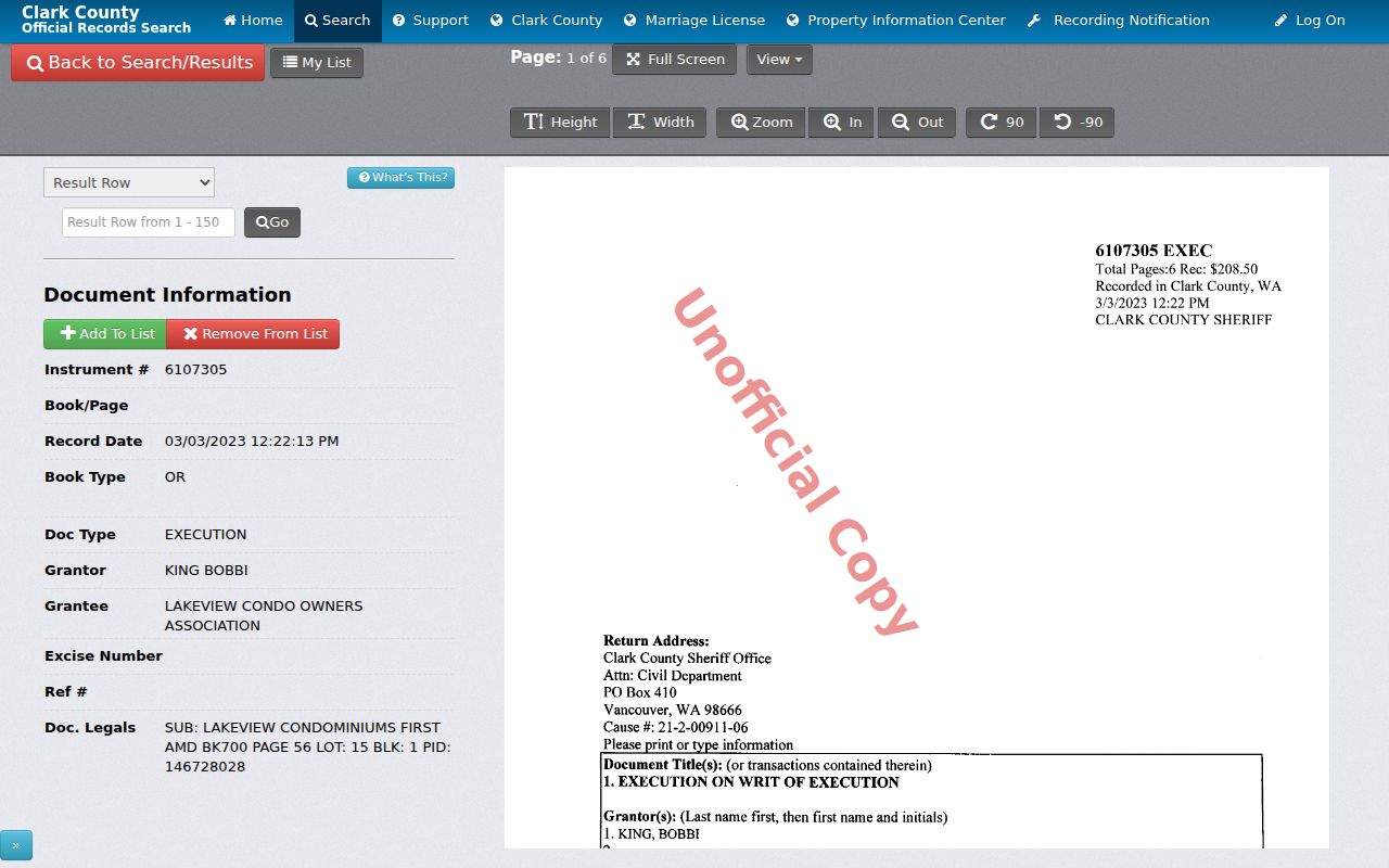
The image is a search example, not a finding about a particular Battle Ground household. Online images are unofficial; a certified copy must come from the Auditor in person or by mail.
Bridge Battle Ground Record Eras
The online cutoff is a handoff point, not the end of the trail. Washington Digital Archives describes Clark County recorded land data from 1998 to present, but its title heading says 1998–2021. Use that narrower title range as the conservative label and check newer filings in Landmark. Search fields include last or company name, first and middle names, Soundex, party type, addition keyword, and year range.
The archive’s Clark County Auditor Recorded Land Records collection appears below. The collection can supply an index hit even when an image is confidential or unavailable.
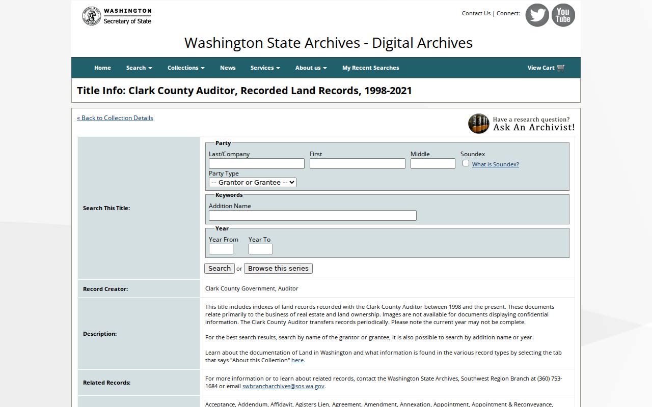
When the image is absent, save the index fields and request the actual instrument from Clark County. For earlier work, FamilySearch lists Clark County deed records from 1859–1921 and index coverage reported through 1977. An account or catalog browsing may be required.
Battle Ground Households Between Records
Deeds identify recorded interests, but previous residents may include people who never appear in the chain. Clark County directories, census schedules, newspaper ads, obituaries, permits, and probate records add the household layer. The Washington State Library lists county directories for 1918–19, 1921, 1928–29, 1931, and 1934. Battle Ground may appear as a post office or county locality rather than under a modern city heading.
- Search the address and street variants in the closest directory year. Save the publisher, volume, page, exact spelling, address, phone, and printed role.
- Pair 1918–19 entries with the 1920 census and 1928–34 entries with the 1930 census. Do not use a newer schedule until it is publicly released.
- Search the same surname, initials, spouse, business, rural route, and post-office label in adjacent sources.
- Confirm a household with a census image, newspaper page, deed, obituary, permit, cemetery record, or probate file.
The historical collections themselves, including how abbreviations and entry types work, are covered in the Battle Ground city directory. Here the directory serves one task: linking a dated address to a possible household and then testing that link against another record.
Map Battle Ground Before Incorporation
Battle Ground’s railroad arrived in 1902, the first town plat dates to 1903, and incorporation followed in 1951. Those dates matter because an early address may use Old Town, East Main, a rural route, a post office, or a Clark County place label. Do not force the wording into the current city limit. Preserve the old form and locate it with the period plat or map.
MapsOnline can compare current taxlots with subdivision, plat, annexation, permit, recent-sale, and historical-aerial layers. Sanborn fire-insurance maps may document building footprints and uses in covered communities, but the inspected research did not establish a complete Battle Ground Sanborn run. Search the Washington State Library and Library of Congress catalog by place and year, then record the sheet number and coverage rather than assuming a map exists for the desired block.
A robust address concordance stores four separate facts: postal city, city-limit situs, tax parcel, and neighborhood geography. ZIP 98604 and the nearby 98606 Brush Prairie/Hockinson area are not interchangeable proof of residence inside Battle Ground.
Battle Ground History Beyond Deeds
Fort Vancouver Regional Libraries provides practical fallbacks for gaps in deeds and directories. Ancestry Library Edition is available only in the library. HeritageQuest, Newspapers.com, NewsBank, FIMO maps, Fold3, ProQuest, and local books have their own access terms. NewsBank coverage for The Columbian in the research runs from May 26, 1994 through April 29, 2024. Clark County Genealogical Society has partial obituary indexes for 1993, 1997, and 1998.
An obituary index is only a lead. Retrieve the newspaper page, compare the name and relatives, and then check a death record, cemetery source, or probate file. The Clark County Clerk keeps civil and probate records across film and digital systems; an old matter may require OnBase, an office terminal, email or mail request, and an archived-film surcharge.
For a hard Battle Ground house-history question, Clark County Historical Museum offers a courtesy research hour, then paid research with a four-to-six-week minimum turnaround. The museum research service is shown below.
Give staff the exact address, known names, date range, parcel or legal description, and sources already checked. That makes the request narrow enough to search local collections well.
Limits on Battle Ground Previous Residents
“Owner” and “occupant” are not synonyms. Assessment records display a named owner and mailing address; deeds show parties to a recorded instrument; directories print the entry their publisher gathered; census schedules capture a household at one enumeration. Each has a date, role, and coverage limit. A previous residents timeline should state those limits beside every name.
Washington’s Address Confidentiality Program gives eligible participants a substitute address and can protect voting and marriage records. If a protected address or redaction appears, use only the public substitute information and stop efforts to reconstruct the actual location. The same care applies to living people found in obituaries, probate notices, or recent deeds.
Lawful house history. Trace Battle Ground past residents for family, estate, property, or historical research. Never use the record chain to stalk, harass, threaten, or expose a living person.